Advanced cross bore inspection, record-keeping capabilities
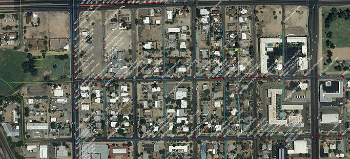
National Underground Group’s GIS data integration provides a quality data management process by building a GIS-based time-stamped library of events as cross bore projects progress. This data management process includes the ability to track production, isolate inconclusive cross bore inspections for further review, and date-stamp final cleared locations.
GIS data integration utilizes cloud technologies to link inspection data (including videos and GPS observations) to GIS-based mapping systems, which results in a comprehensive, date-stamped library, vetted by a highly experienced quality-control team. This enables full viewer access to the GIS mapping software by log-in.
Cross bore inspection program delivers comprehensive benefits
Experienced GIS data integration professionals guide our clients through their program from start to finish. We complete risk assessments and evaluate the areas that need inspection first. After the inspection, data can be viewed and analyzed using a customized, user friendly, online portal.
The program offers several key advantages:
- Operates latest robotic lateral launch systems from the sewer manhole through a lateral
- Assesses a range of pipe types, extending up to 100 feet to the structural foundation
- Utilizes cloud technologies, linking inspection data to GIS-based mapping systems
- Provides inspection details from quality control teams, creating a vetted, date-stamped library indefinitely should a damaging event occur
Essential cross bore inspection program guards safety with information
National Underground Group’s cross bore inspection program enhances safety and mitigates risk. A thorough underground pipe inspection conducted using advanced technology provides utility owners with the backup data that identifies safe and threatening conditions in the inspected area before or after the excavation of new or replacement lines.
GIS data integration enables complex data management and integrations that provide our clients with easy access to their inspection data. This information helps keep communities safe and reduces the risk for utility owners.
Service Lines
Pro-Pipe
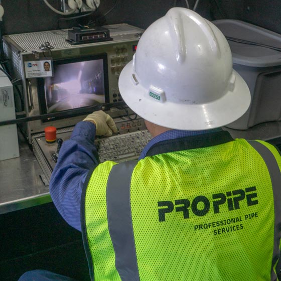
Pro-Pipe provides cross bore inspection and pre- and post-construction inspections for trenchless installations. Utilizing advanced technology and sophisticated equipment, Pro-Pipe digitally maps (GIS) underground infrastructure, provides condition scoring for prioritization and assessment, and offers comprehensive maintenance and rehabilitation.
Go to Pro-Pipe Go to Pro-Pipe Go to Pro-Pipe
Pro-Pipe
Pro-Pipe provides cross bore inspection and pre- and post-construction inspections for trenchless installations. Utilizing advanced technology and sophisticated equipment, Pro-Pipe digitally maps (GIS) underground infrastructure, provides condition scoring for prioritization and assessment, and offers comprehensive maintenance and rehabilitation.
Go to Pro-Pipe Go to Pro-Pipe Go to Pro-Pipe