
811/Contract Locating
811 locating helps protect existing subsurface utilities from damage during excavation-related construction by adhering to regulatory procedures.
Go to 811/Contract Locating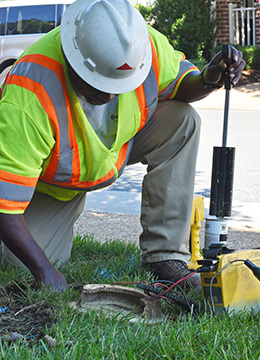
Subsurface utility locating and mapping services reduce and usually eliminate damages to existing underground utilities during any kind of excavation. These services are also crucial to a project’s initial design and civil engineering phases. National Underground Group locates underground utilities, including gas, water, sewer, electric and fiber optic lines, for municipalities and utility owners and their engineers. In addition, we offer our utility locating services to homeowners and contractors.
Our locating process includes identifying and contacting owners of utilities that fall with a project site area and investigating all available records, plans and maps of the purposed subsurface construction route. In addition, we conduct a visual inspection of all above-ground utility features on the project site and an electronic search of the site to identify the approximate location of buried utilities and metallic structures or objects. And, upon completion of all mapping and field notes of the location, direction and configuration of utilities, the collected data is sent to stakeholders in the form of an AutoCAD or MicroStation file.
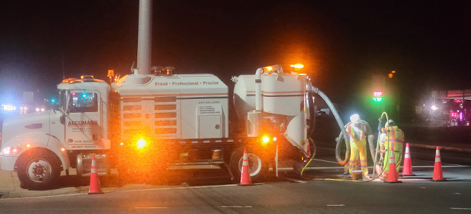
In the course of locating subsurface utilities, a range of equipment may be used that could include designating equipment, vacuum excavation or comparable non-destructive locating equipment, advanced surveying and data recording equipment, and software systems.
811 locating helps protect existing subsurface utilities from damage during excavation-related construction by adhering to regulatory procedures.
Go to 811/Contract Locating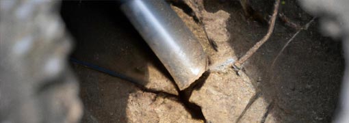
SUE assists engineers and architects by mapping as-built or existing underground utility lines to avoid potential issues.
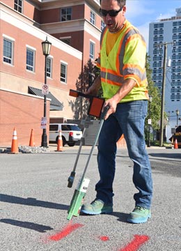
Go to Subsurface Utility Engineering (SUE)Prior to any outdoor excavation utility project, managers should call the national call-before-you-dig phone number: 811. This ensures subsurface gas, water, sewer, electric and communication lines can be located and marked before infrastructure installation or rehabilitation. National Underground Group locates underground utilities for municipalities and utility owners and their engineers. In addition, we offer our utility locating services to our professional and private customers.
Our Subsurface Utility Engineering (SUE) helps protect infrastructure project stakeholders from damaging existing utilities during subsurface installations or rehabilitation. Data collected from SUE investigations is correlated with the often less-exact data found in records and maps to help determine the existence and approximate location of below-ground utilities and metallic structures or objects. Direction and configuration of utilities are sent to our customers in the form of an AutoCAD or MicroStation file.
When it comes to projects for municipalities and government agencies, on-time delivery is key. National Underground Group’s data-driven approach to pipe and infrastructure inspection enables construction stakeholders to better plan their subsurface repair and installation projects. Accurate and available inspection information enables construction crews to work safely and efficiently, adhere to regulatory standards, and guard against damage to existing infrastructure, project delays and budget overruns. We also offer preventive and proactive solutions that help keep subsurface pipes in optimal condition.
To ensure the continued integrity of existing subsurface gas lines and the safe and efficient installation of new infrastructure, National Underground Group provides comprehensive pipeline inspection and locating services. Our complete inspection, quality control and data record management process provides the data to effectively maintain assets and help prevent cross bores, which can present safety and damage risks. Inspection and locating is particularly important when trenchless technologies are used in areas with subsurface pipelines that convey gas and other hazardous materials.
National Underground Group’s engineering industry pipeline services include a range of accurate and efficient evaluations. We use advanced closed-circuit television (CCTV) technology to produce Pipeline Assessment Certification Program (PACP) exchange databases, and conduct thorough CCTV lateral launch inspections and engineering CCTV mainline inspections to provide accurate, reliable data that facilitates optimal timing and methods for repair and maintenance. From pipe locating and mapping, cleaning and assessment to trenchless rehabilitation and cross bore inspection, we provide solutions engineers need to satisfy their clients.
Contractors who work on subsurface wastewater infrastructure installation or repair projects find the most reliable support from a subsurface pipe specialist with a range of capabilities. National Underground Group provides all the services for an infrastructure project and tailors solutions to the specific requirements of our contractor clients. We know the safest, most efficient and cost-effective methods for performing subsurface pipe inspections, maintenance, installation and repair and use the most advanced technologies to ensure jobs are completed on time and on budget.
We tailor our services to meet each client's unique goals and budgetary requirements—without unnecessary delays or workovers.
Ask Us First